Chirripo Beast-o
We have now been back from the 0km mark of the Chirripo trail for a few days and I feel like I have the energy to clearly articulate & share the experience. Note: we also took video footage at every mile marker on the way up and intermittently after, but it may or may not have turned out… I’m not sure yet at what point the LOCO sets in, but trust me when I say to be prepared for it, but…
WE DID IT, WE DID IT, WE DID IT!!!
What is Chirripo: For those of you not familiar with Chirripo, let me give you a few quick facts.
Highest mountain in Costa Rica at 3,821m (12,536ft)
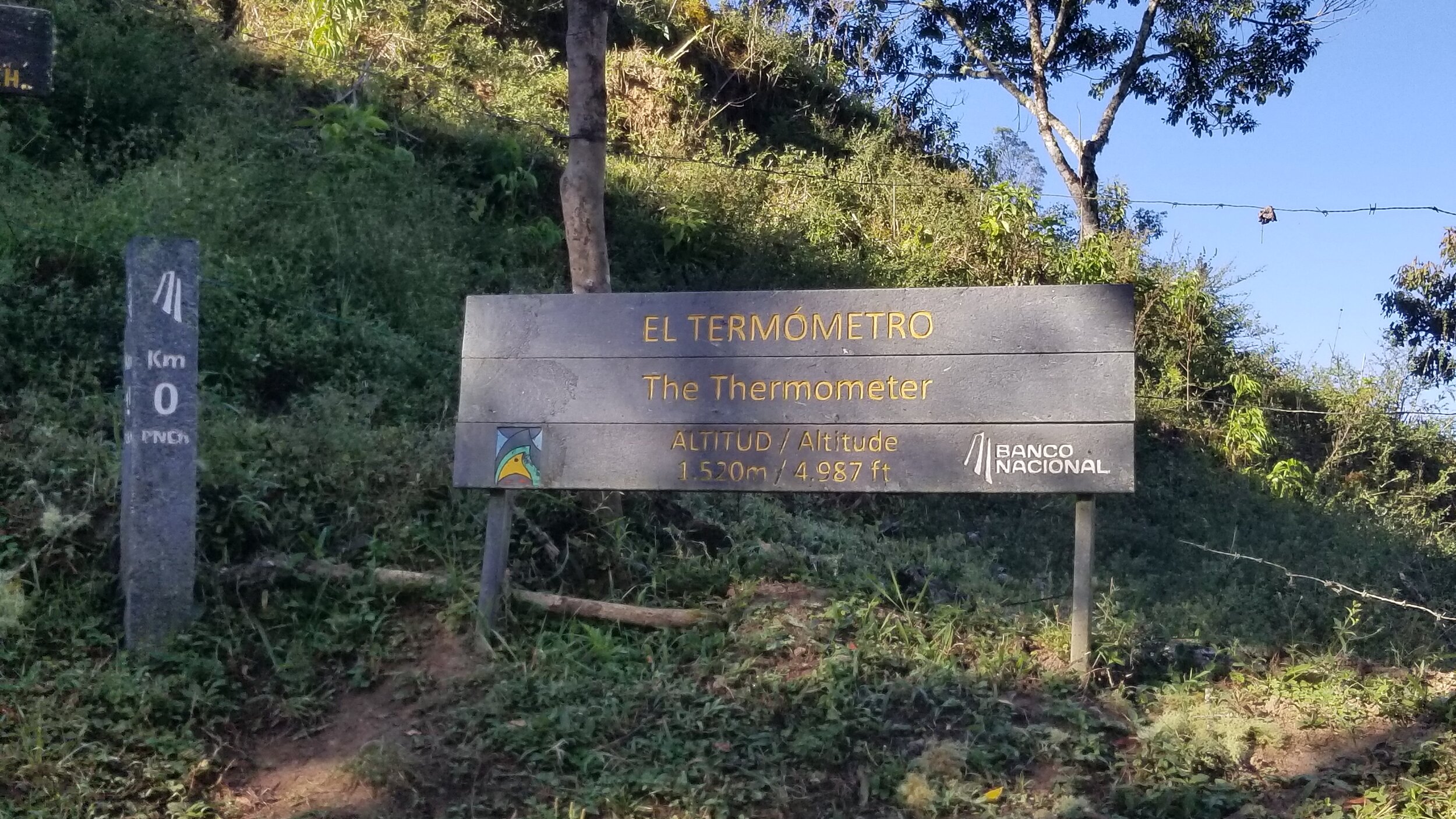
Trail head’s starting elevation of 1,500m (~4,900ft)
On a clear day, you can see both the Pacific ocean & Caribbean sea
Snow has not fallen on the peak for +100yrs
Trail is only able to be reached by foot or horse/mule
I became very amused by this “challenge” since I started researching the country, was able to find some permits available, so we went for it! At the time I booked the permits (~1 month before the hike), there was no room at base camp and tenting is not allowed. So we booked permits with the intention of bossing this summit both ways in a single day. This is the story of that.
Now don’t get me wrong, it was amazing - everything from 5 hours of hiking in the dark, to the 9,000+ feet of elevation gain, to the double summits, to the hands & knees crawling up to the summit. All SO damn worth it and I would do it again for a first time even knowing what I know now (not sure about round 2 though…).
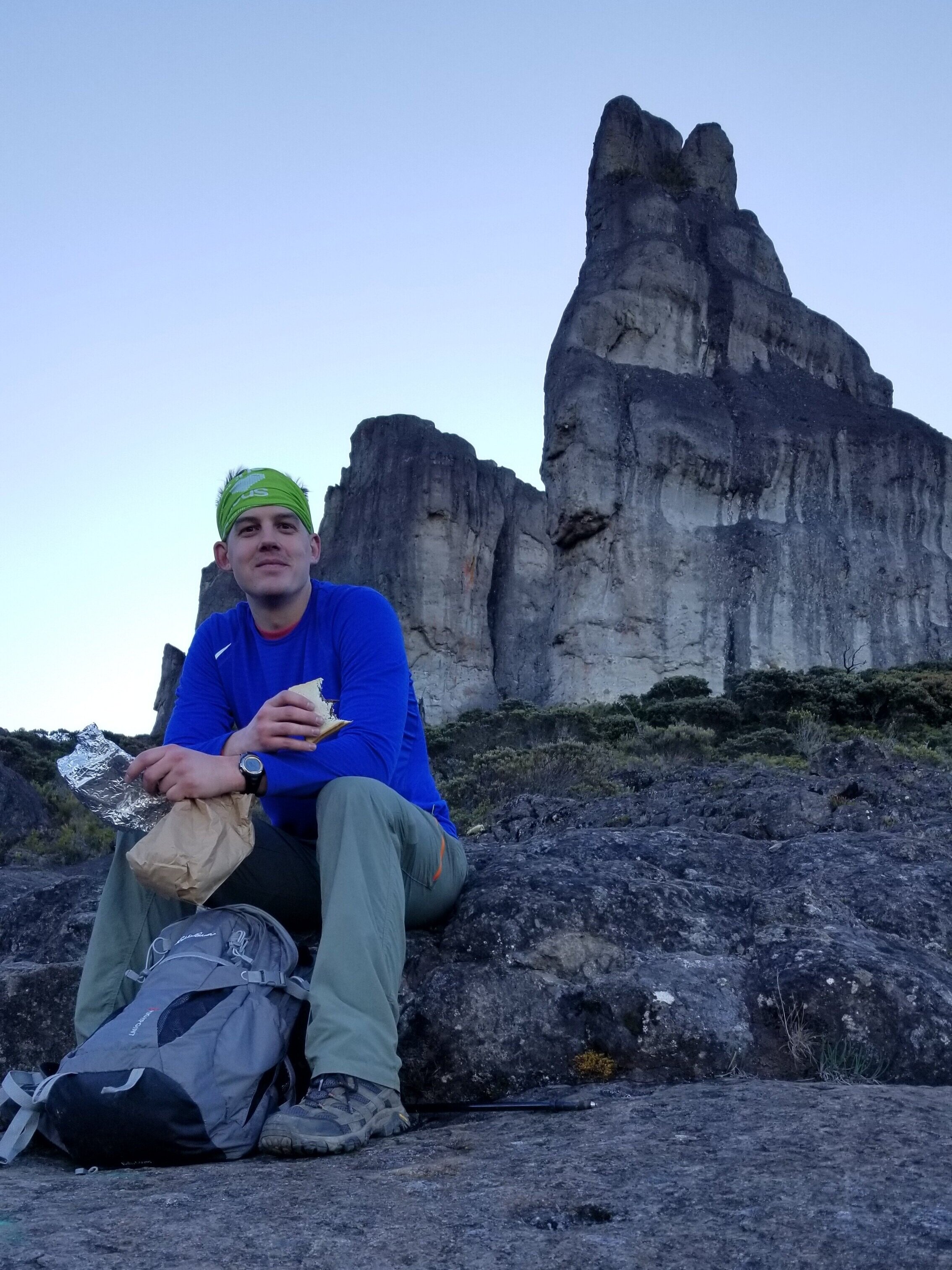
Phase I - How the day began: we went to bed at 6PM the night before to try to get some hours of sleep. Fortunately, both of us were pretty KO’ed, so it wasn’t a problem #oldpeopleproblems We woke up around 12:30AM & were ready to hit the trails. Unsure of what the weather at the summit would be like, we wore a few layers as we were told it can get down to 0C (32F). We had adrenaline and were G2G, on the trail by 1AM at a whopping starting elevation of 4,987ft!
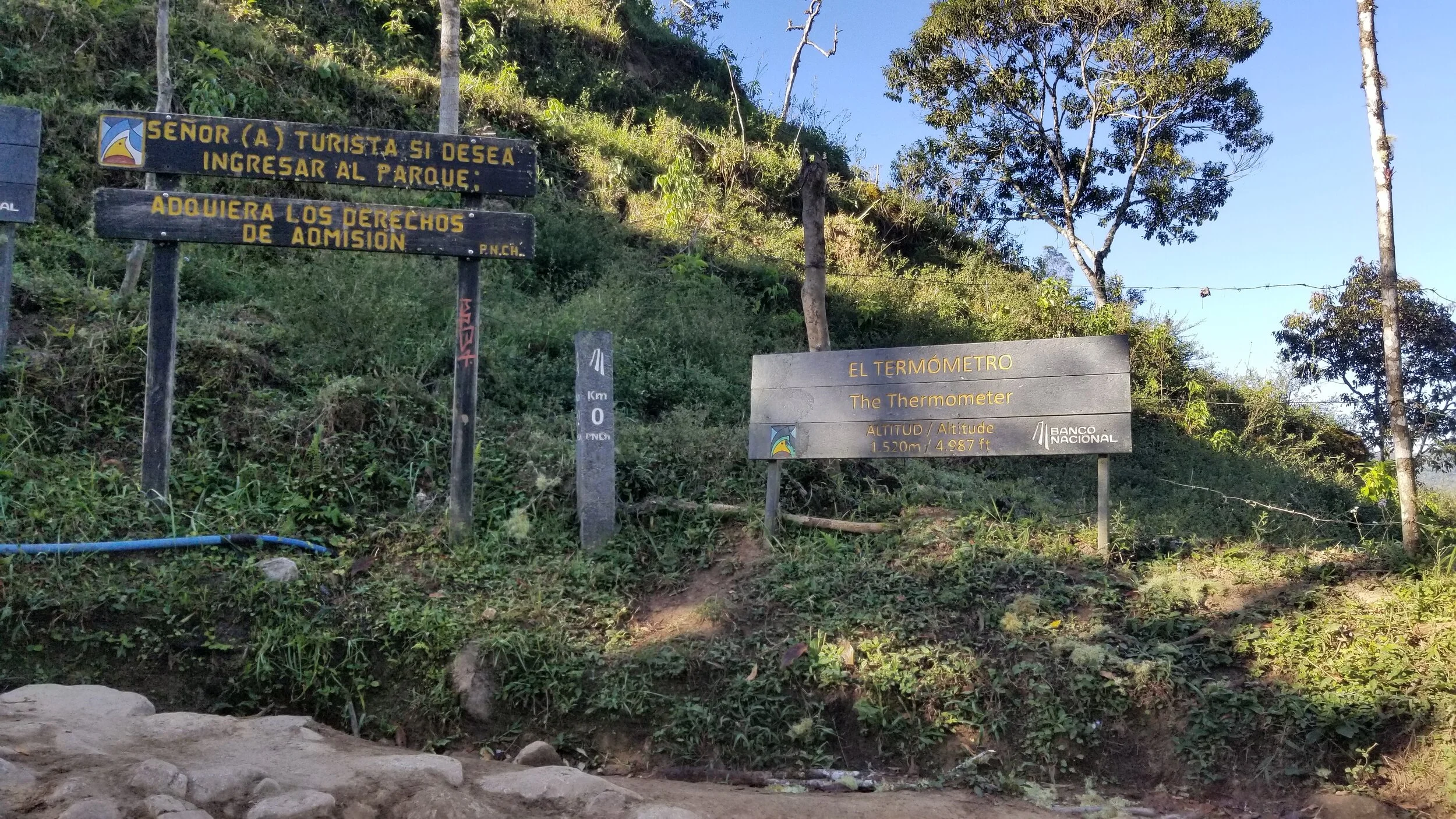
Hitting the trail: the trail was ~100ft out the door of our hotel which was amazing. It’s all km marked very well with posts, even the first one at 0km. We kissed the entrance goodbye and started km 1 which was just a measly 800ft of gain…(JOKES ‘cause HOLY SHIT!!!). Don’t worry, they aren’t all like that, but I can tell you that some are even more gain than that.
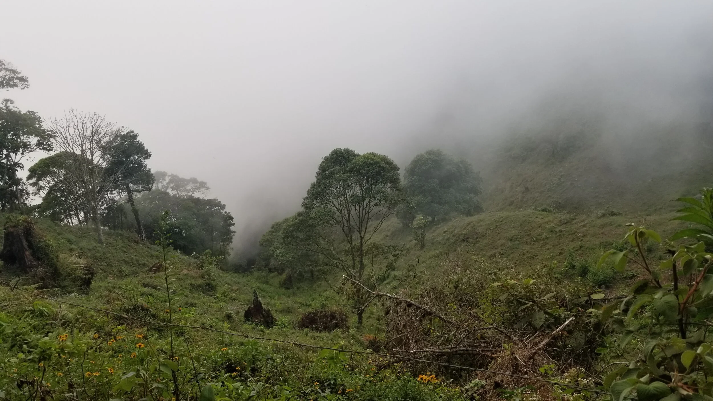
Phase II - Night hiking: Of course starting at 1AM, everything is dark, so you just see the trail in front of you. The trail is pretty nicely groomed, but VERY rocky, so hiking boots are a must to protect the ankles! The first 10km or so are in the heart of the jungle. The jungle is already a mysterious place, so a dark jungle is 10x more mysterious. Night hiking actually made time go by very quickly. Other perks - no bugs, great temperature, no scorching SUN, unknown path ahead of you so minimal head games! We loved it. And so did the horses. We got passed by 5ish horses and leader pairs. They book it up the mountain at a jog/run pace; it’s quite impressive! You want to get in the best shape of your life? Become a Chirripo porter.
Dirty A$$ b: we were feeling really good until we got to a real betch part of the trail. Just after 7km, you hit a big shelter place. Water, banos, etc. 7km also means halfway to base; cool, we’re rocking it! Almost immediately after, you get SMACKED in the face by km 7.5. After seeing elevation maps, it all makes sense, but this hill was mean…and unrelenting…and talked back to us…and lasted for almost TWO KILOMETERS. Non.stop.gnarly.uphill. This was the point that Jake walled and needed a pep talk. Don’t worry - you’re sista was there to rescue his defeated soul! This is the benefit of partner hiking, you take turns picking each other up because over 17 hours, you are bound to wall at some point.
Phase II - The sunrise: a huge attraction at Chirripo is hitting it for the sunrise. After seeing the trail and knowing what I had to climb to summit Chirripo, doing that in the dark sounds quite terrifying, but also really exhilarating. We, of course, were not going to make Chirripo by sunrise as all reads tell you to plan 5-7 hours just to get to base. When the sun started peeking out, we had hit the part of the trail that was exposed and out of the mountain (around 10km). It was beautiful and felt so freaking high; it’s one of the more beautiful things about night hiking. The world awakens and you get to look out and say “Yeahhhhh, I did that!” Once it gets light out, you almost feel like it’s a new day as well which helps with energy level and motivation.
Jen’s defeat: I will say, I was really mind-over-mattering this beast, but when we were just about to km 13, we saw a sign that said “Base camp, 1.5km”. ONE POINT FIVE?!?!?! It was a mistake I hope no one else makes, but for some reason I had it in my head that base was at 13km. In reality, it was AFTER 14 km, probably nearly at 14.5km. It doesn’t sound like a huge difference, but every km takes ~20mins. Jake fortunately took the motivation stick and was the voice of reason calling me back from the cliff edge I was about to jump off of.
Our goal was to get to base in the 6AM hour. With the last couple km without headlamps, we landed at base camp at 6:15AM and had a great cup of coffee that would help us fly to the mountain tops, as they were still kms (yes, plural) away.
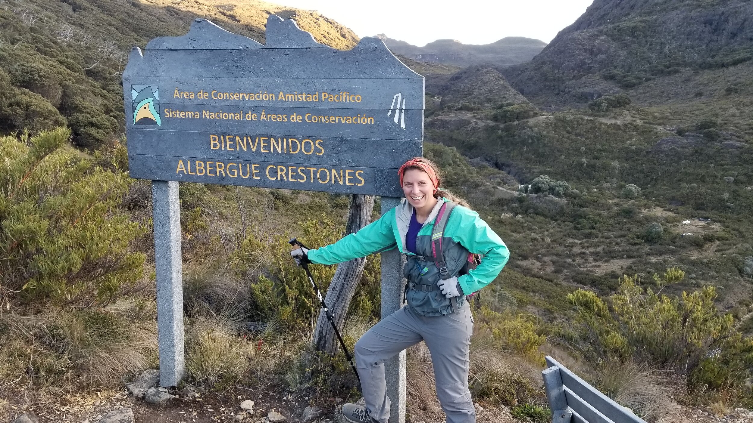
Phase III - Base camp onward: as I once though we never would do, we HIT base camp! #blessed Base camp is a basic shelter up at the base of the real peaks. It’s a simple set-up - has 52 empty mattresses for visitors, a water fountain, and a small cafeteria. Pack mules bring up all of their supplies a the only way to get to it is by foot!! Once we hit base, a new set of energy came over us as we were feeling like WE WERE THERE. In all actuality, just to Chirripo is another 5km from base. Being in a slight lunatic state, we of course added to the course because now that we made it all of this way why not hit 2 summits?!? The Los Crestones to Mt Terbi loop was a warm-up to Mt Chirripo (as if the first 6 hours of hiking weren’t enough)! We actually met some locals the night before that told us Chirripo gets packed in the AM, but if you go Terbi first, you’ll likely have all of the mountains to yourself. Being the rogue adventurers we are, we signed up and can say this was great advice!
Phase IV - Summit 1: on the Crestones loop, you climb pretty aggressively, but the Crestones are in view the entire time which makes it exciting. We had fun on this trail and it’s really beautiful (crestones is something like “crests” in translation)! Sandy pitstop and we were on our way.
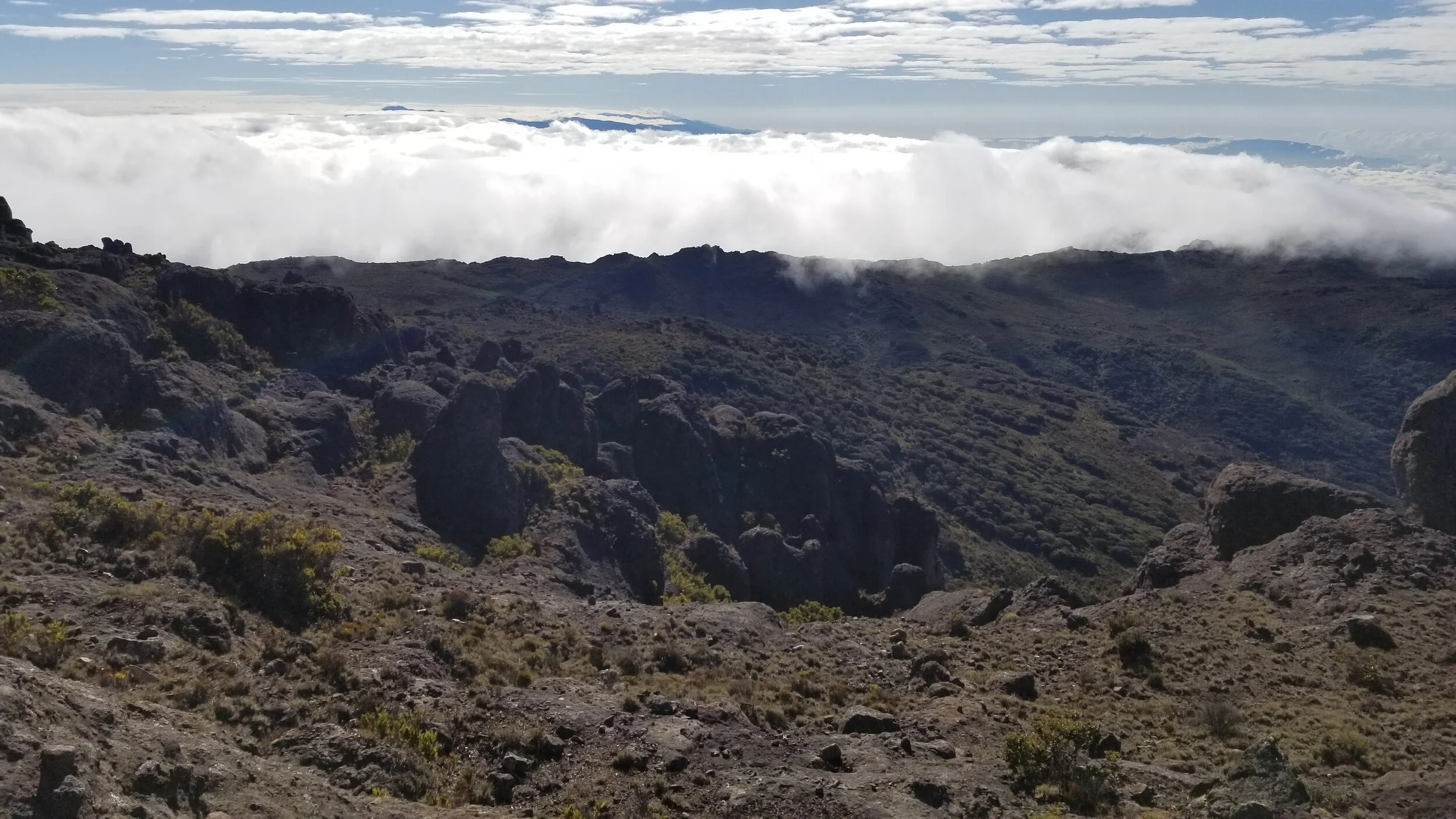
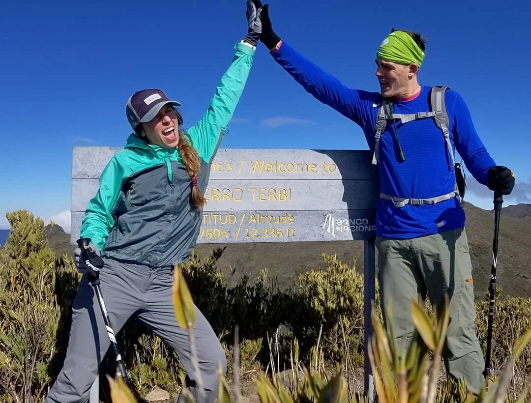
Shortly after the breathtaking Crestones you climb along the ridge until you get to Terbi. We summitted Terbi (elevation 12,290ft) around 9AM, reminding ourselves that just 8 hours earlier, we were sleeping at ~4,990ft. It was breathtaking. On one side, we could see the ocean and the other side had some gnarly, ominous clouds rolling in. The weather up top is wicked. And by that I mean that there are clouds constantly rolling through, not above you, but through you. You are in the clouds. Some bring moisture, some dissipate before they get to you, some are low in the valley. They also move so fast that every 10 minutes looks like a different forecast. (hey ya’ll, it’s weather girl Jen)
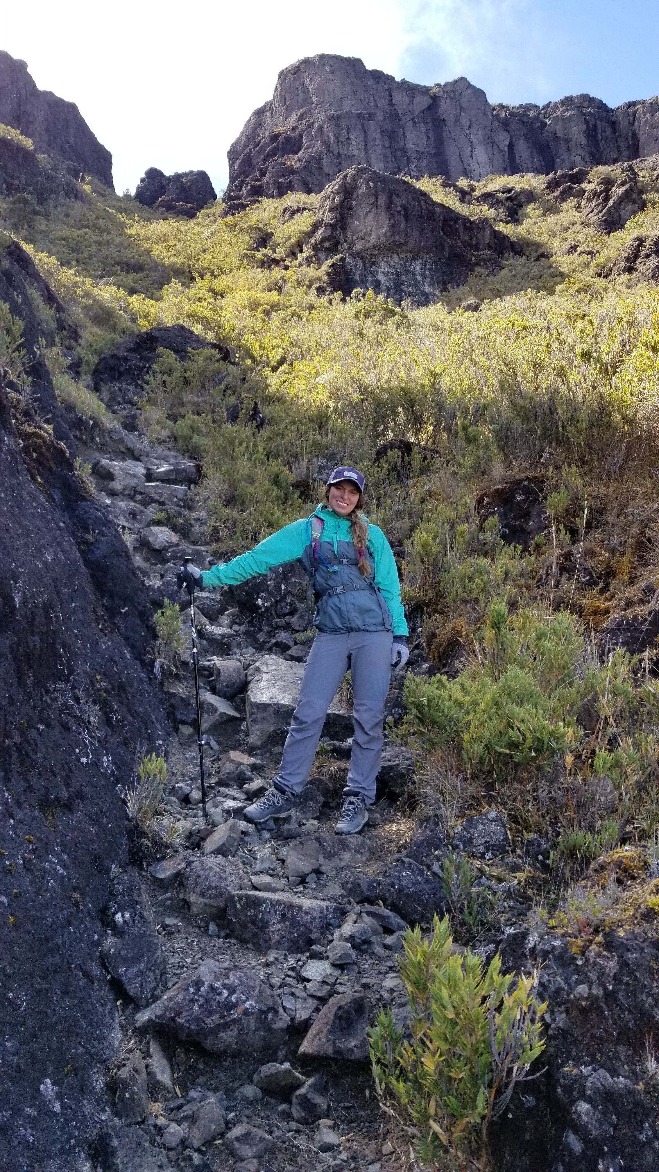
Phase V - Summit 2, Cerro Chirripo: we were feeling pretty accomplished after Terbi. Only a few minutes later did we realize that we could see the Chirripo trail on the opposite side of the mountain which you could only get to by going back down into the valley. SO we started a downward trek (~1,100ft) to the valley and to the trailhead of Chirripo. This descent was nothing we had done thus far, which is to be expected as we had been climbing for all hours. Truly, this was as vertical as a climb can get without needing climbing gear. But the saddest part about it is that every step down, you know that just means another step up because we still have the tallest summit ahead of us. :( We still managed to keep our head up at this point because the excitement was real. We hit the valley and started the upwards trek.
This is a snip of the gnarly downhill crawl. It was steeper than it looks, okay!!
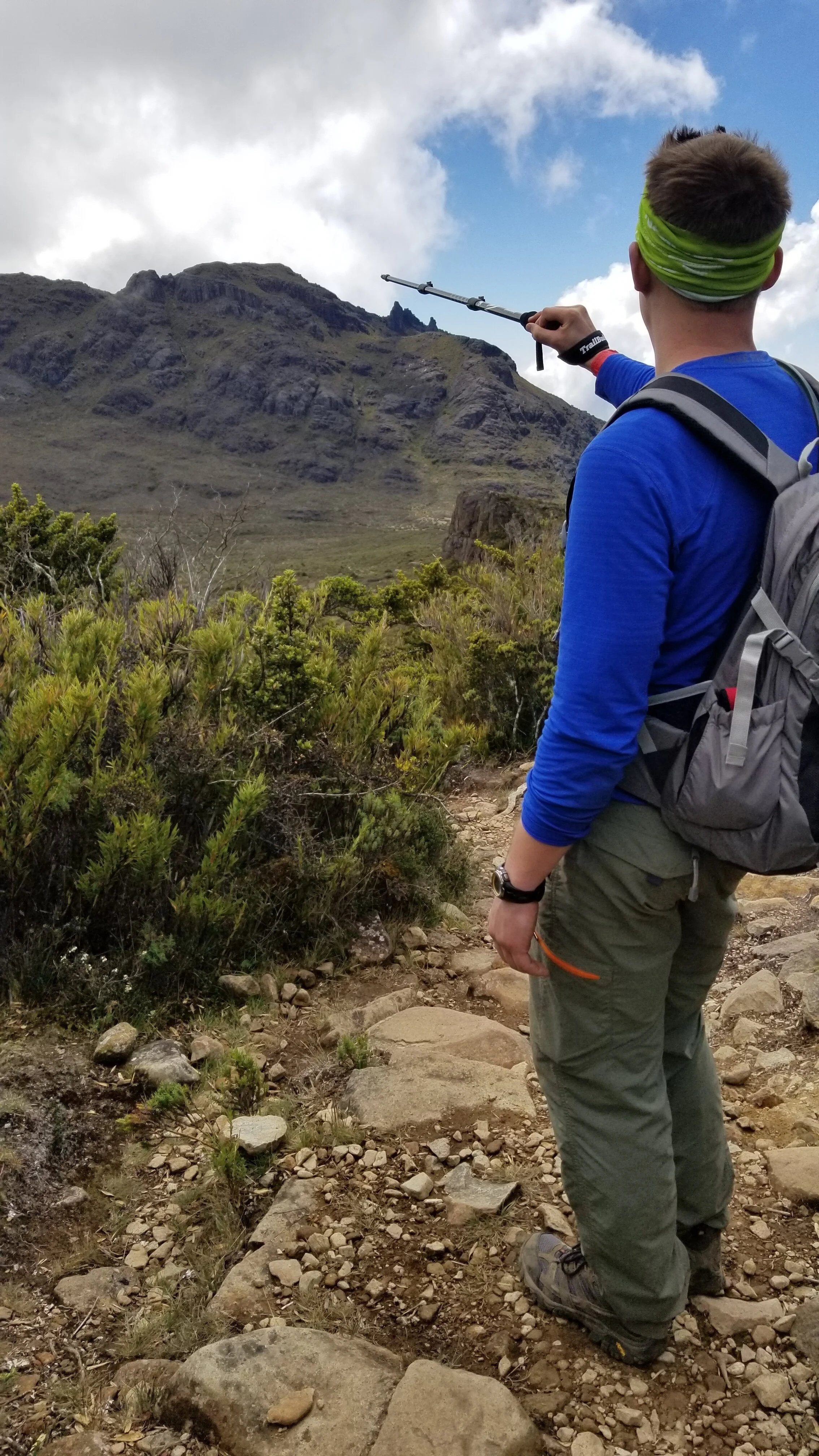
This is a pic from the Chirripo side pointing at the general area of Mt. Terbi
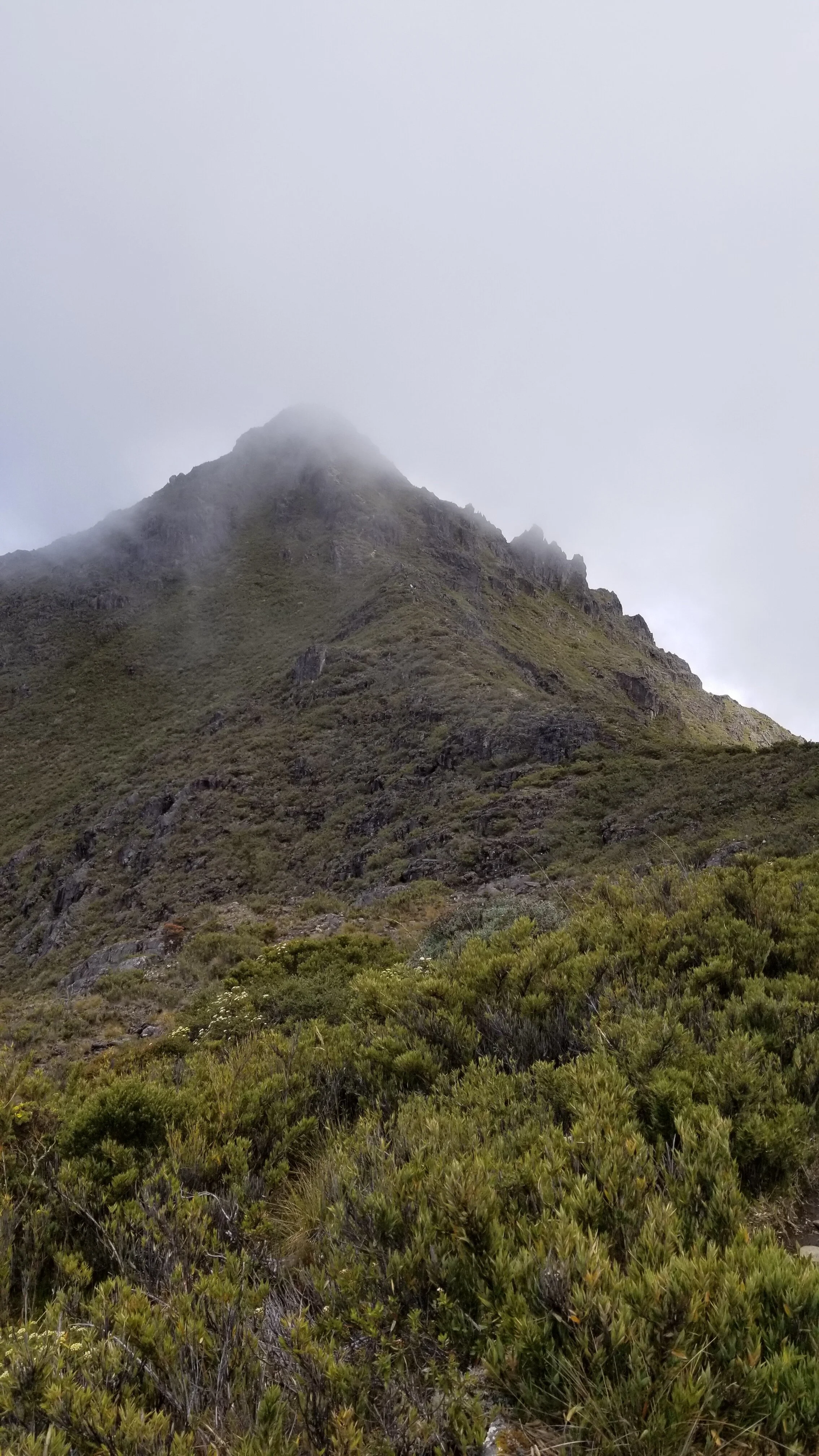
We thought we saw Chirripo about 4 different times, but were proven wrong when we saw the real Chirripo. It’s cone shaped and pretty hidden behind the other mountains in the valley. You know it’s Chirripo because 1) you are on the trail with signs saying “Cerro Chirripo” and 2) you can see a skinny dirt path leading up the center of the mountain. By this time (~10AM), the clouds were rolling through pretty steadily, so Chirripo was looking extra threatening. In the 2km Chirripo trail, you climb over 1,200ft with majority of that in the last 0.5km. The path gets skinny and extremely rocky with cliffs on all edges; hands & knees-style are required to keep your body leaning forward and not off the edge (this is one reason why going in crowded times are less ideal). Our breathing wasn’t doing so hot at this point and we had to stop to catch our breath every ~10 steps.
Just.keep.swimming.
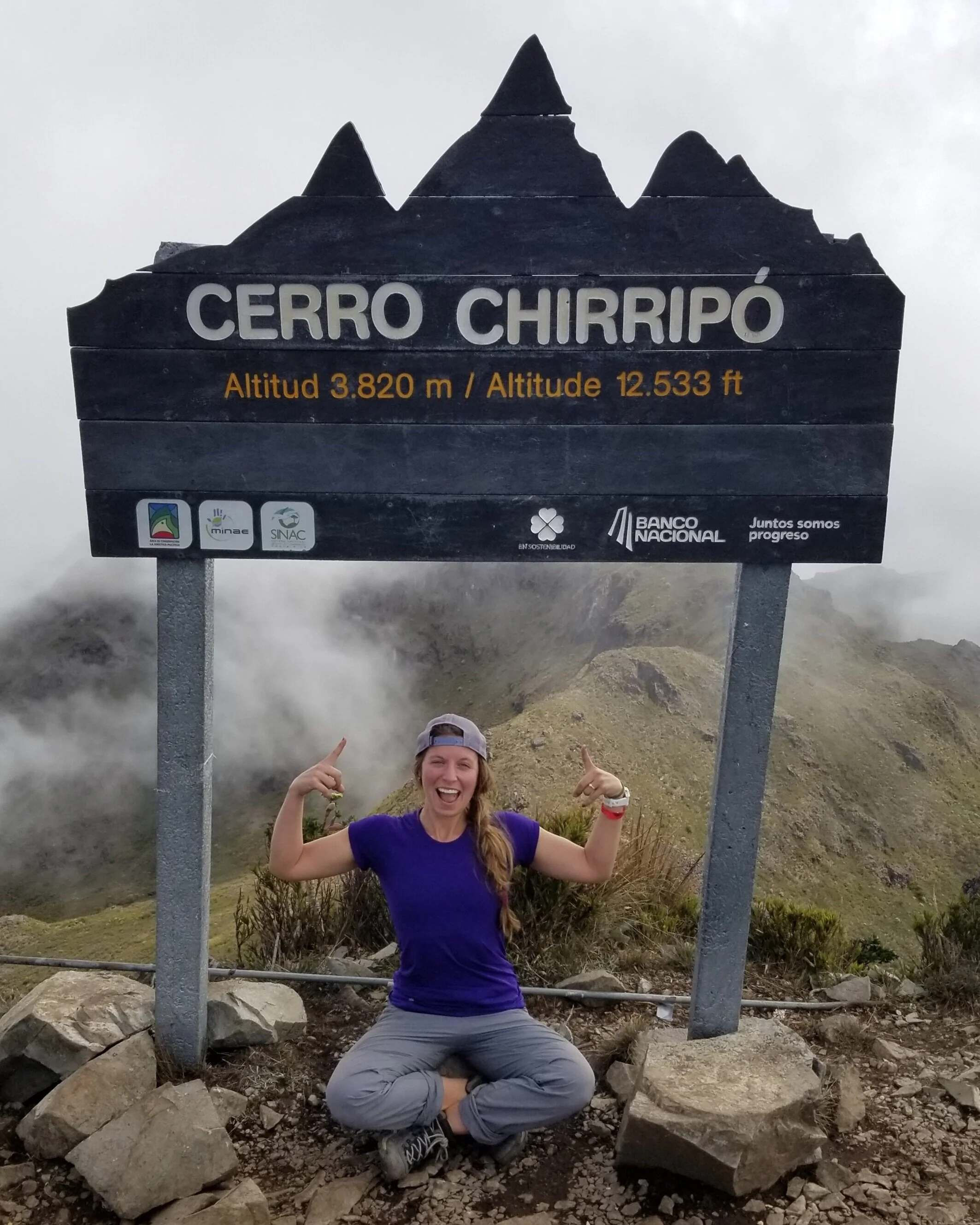
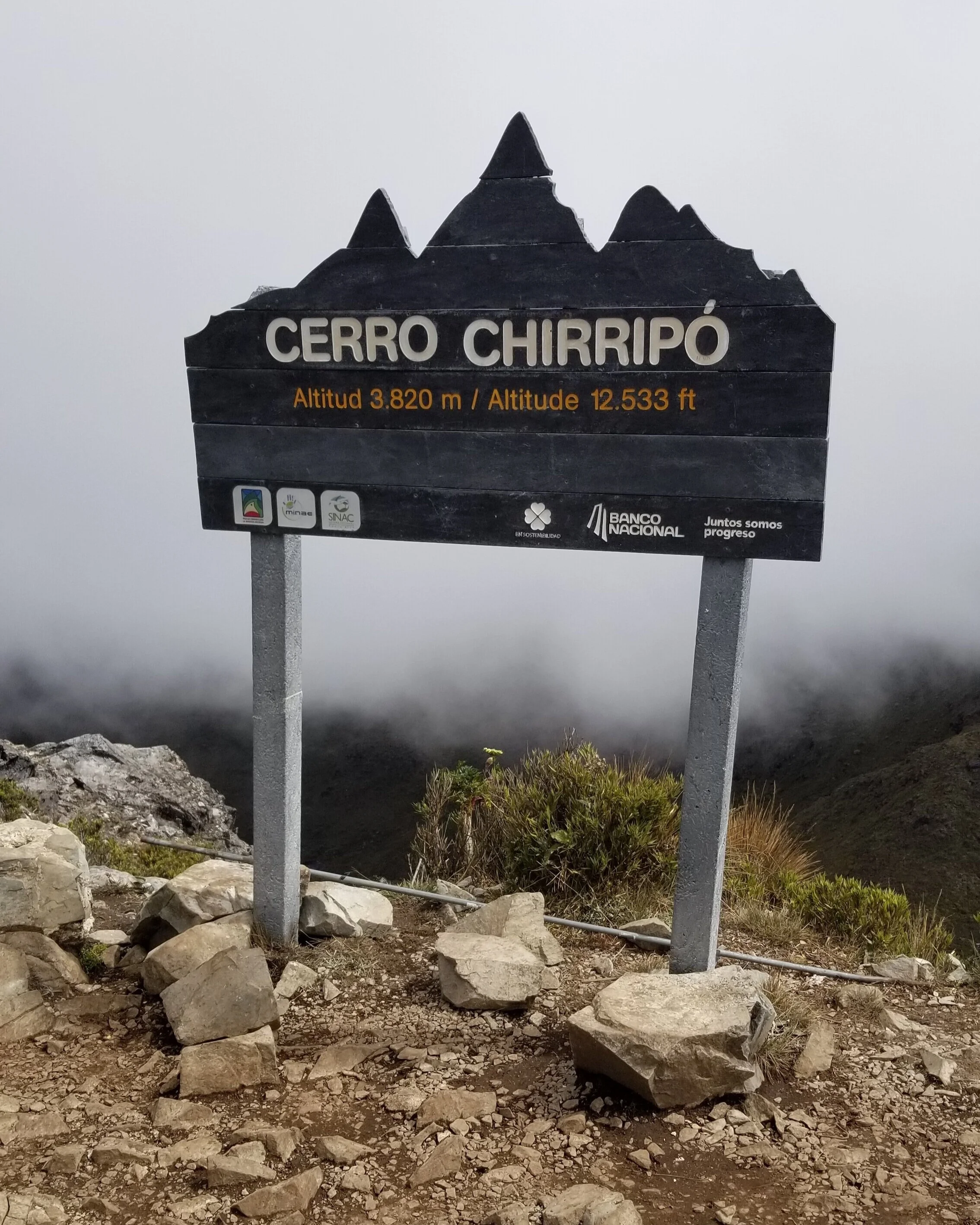
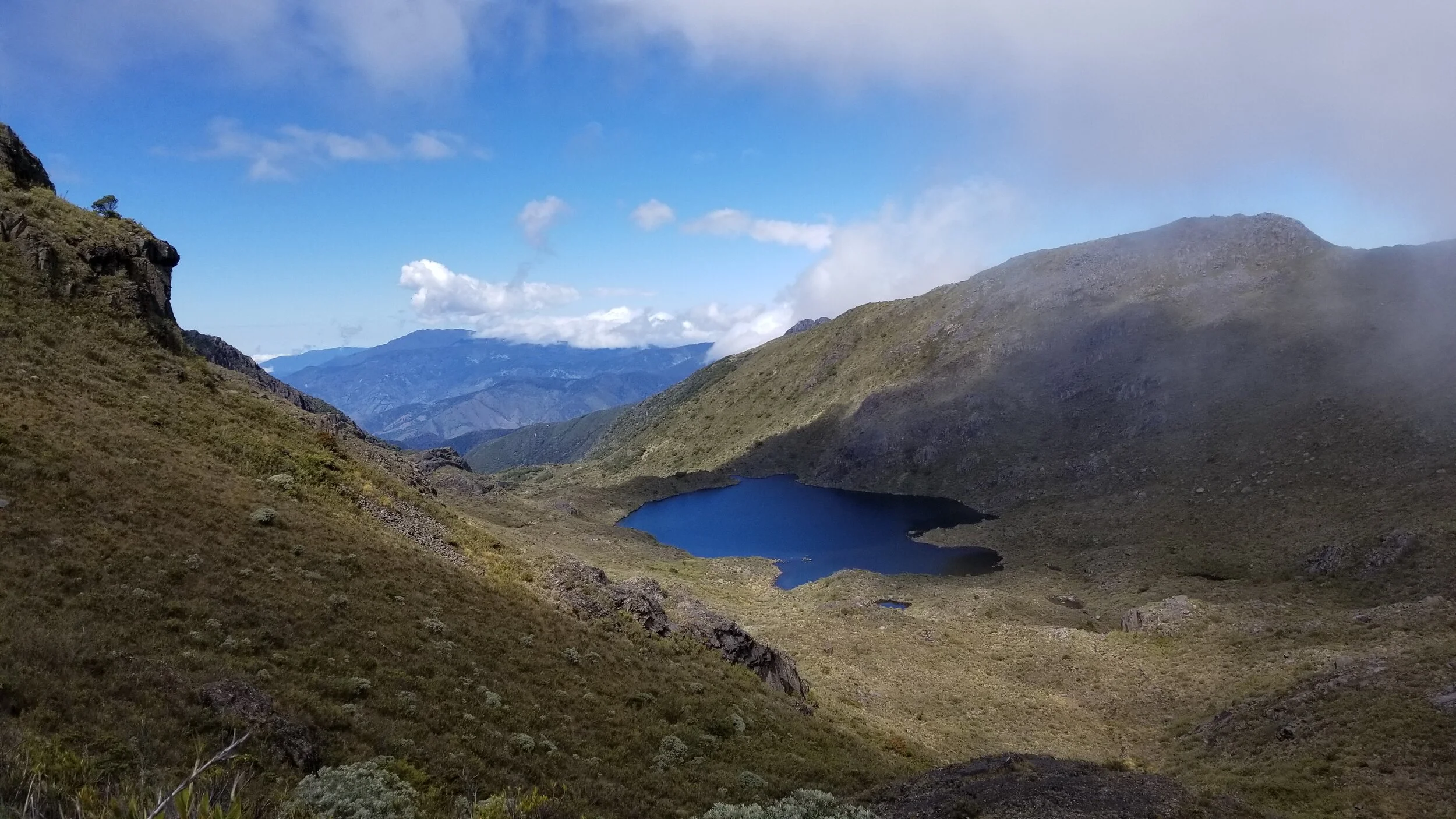
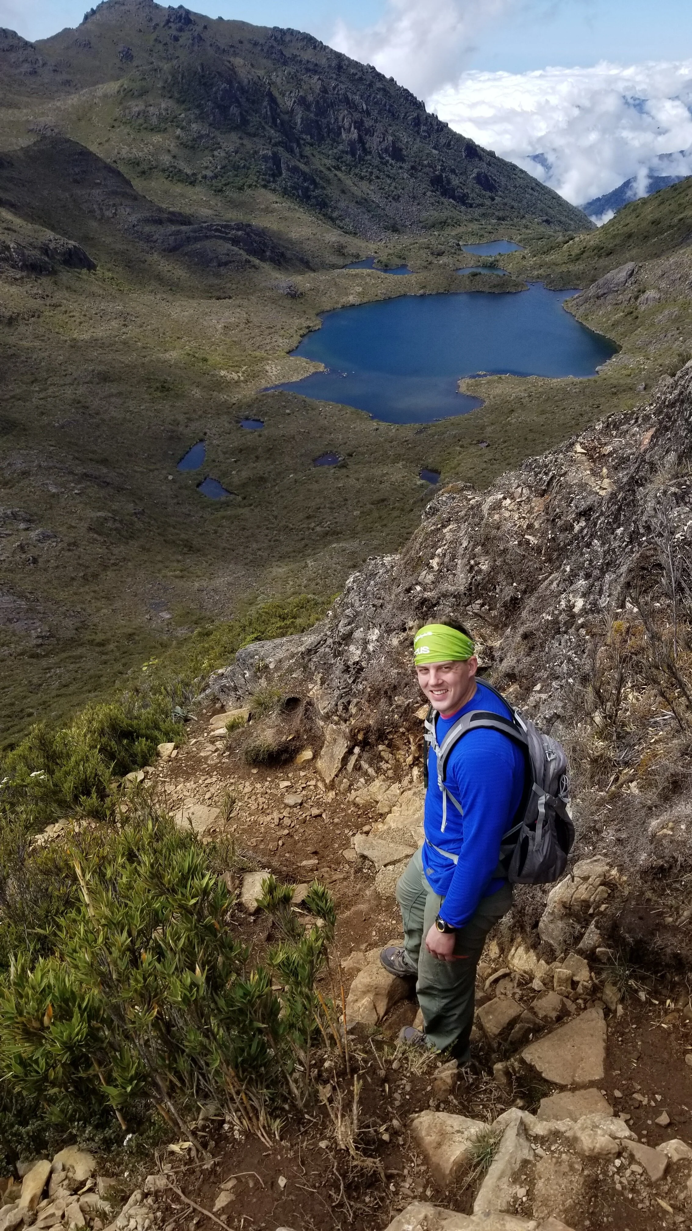
Phase VI - Cerro CHIRRIPO: but then we reached the summit, all 12,533 ft of it, around 10:30AM. We were there, on top of Costa Rica. The greatest sense of accomplishment fled through me. We were the ONLY people on Chirripo at this point; the ONLY ones. One side was extremely cloud-covered with little to no visibility while the other side was breathtaking and so clear with the most crystal blue glacial lake. We caught our breath for a minute, took it all in for a few, snacked on what we had left of our pistachios (team #packsnacks), took a couple sign pics and embraced the few minutes we had to relish. After all, we were only halfway through the trek…
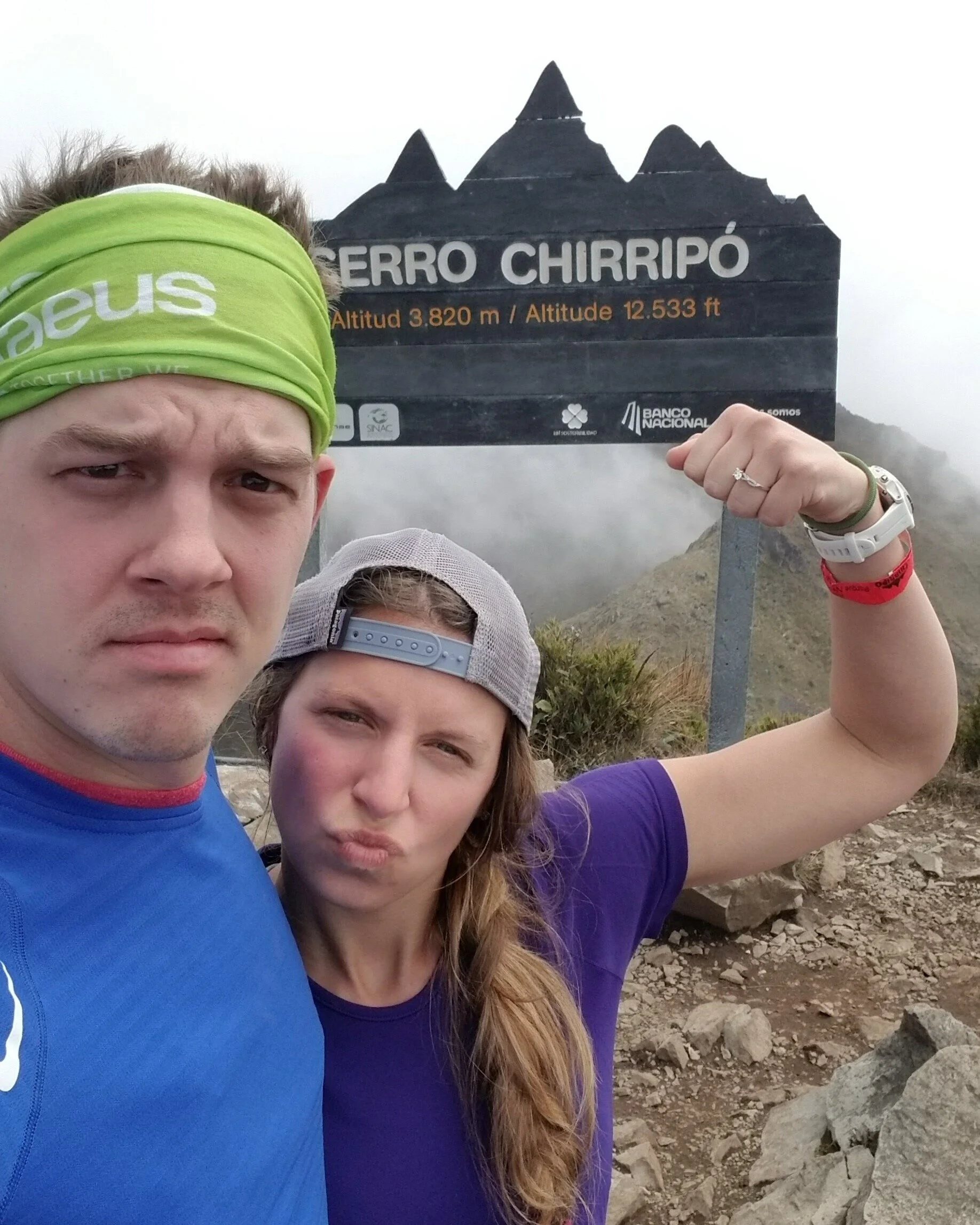
I MEAN, LOOK AT THIS VIEW!
Phase VII - The Descent: the way down Chirripo is pretty intense, def not for those who are afraid of heights. As rules on steep inclines and declines, keep your body close to the mountain! Breathing is much less of a problem on the downhills though, so we were a bit faster moving. Honestly, my body was just so happy to be flexing my calves in a new direction. Once we reached the top of Chirripo, I realized my water was gone as I started sucking in air. Luckily, Jake still had a bit left - about 5 mins worth. We knew down in the valley there was a nice flowing stream and we had packed our Sawyer filter, so just a couple km away from water.
The weather was doing some misting due to the clouds over us, but would mix in patches of intense sun as well (proof from our sunburn). Filtered some ounces of H2O) at valley and were off for base. This small victories or milestones really kept our head in the game. It was very critical for us to have small milestones along the journey to not become defeated. We had pre-ordered lunch at Base, so we knew we had a hot meal awaiting us. When you have been fueling on Cliff bars and peanut butter packs for the past 12hrs, a warm meal is all you need for motivation! Looking back, the taste of the warm meal was less than desirable, but all we needed were cals at that point. You have to change your standards and perspective a bit when you realize that everything they have up at base is either porter’ed up by horses or gardened on an 11,000ft mountain. When you think of it like that, it’s not so bad to pay $14 for dry white rice w/a dry corn tortilla and a bowl of yuca/carrot/potato stew. We needed fuel, it didn’t matter the flavor.
Sun-sick: we took off from base knowing we had 14km ahead of us. Phewwww, deep breaths. We CAN do this. It was the peak hours of sun at this time and the sun was draining me. I knew we only had from km 14 - 10 in serious sun exposure, but that meant over an hour getting torched in the sun. I stripped off some layers, reapplied sunscreen, and tried my very best to keep in the shade. We also turned on some tunes at this point as our bodies were quite defeated and needed an extra something. We found the jungle, praised the lord, and went for the final 10. These next 5 were fine; a few had some nice flat ground and some even mixed in an uphill which we were now appreciating! We had another run-in with DAB (mile 8-9km) and gave her some nice words before continuing the descent.
Phase VII.I - the last 5KM: …were tough….the toughest of the trek, both physically and mentally. You feel so close (7/8th DONE), but you know you are still nearly 2 hours away from the bottom. TORTURE!
The mind games set in, the blistering feet set in, and the body fatigue sets in.
We were so depleted that we couldn’t do anything but put one foot in front of the other (even 20 questions was too much - HA). We hiked in a lot of silence and a lot of looking around every corner in hopes of finding a mile marker (or my long-sleeve thermal I lost on the way up). The ominous feels of night started settling in as well in the jungle. The fog turned up and you could only really see directly in front of you - I’m not sure if this is better or worse for the mind.
Phase VIII - glorious 0 marker: we hit a sign after 1km that said “700m to Hotel Uran” which was where we were staying. When you are used to talking in ‘ft’, 700 doesn’t seem to bad. But remember that meters are 3x that. The last 700METERS. Okay, we are so close we can do it. Honestly, it seemed to take 20mins for the last 700m itself. As I said, the first km is ~800ft of gain, so not a small hill. We were walking like grandpa’s with single trekking pole canes. When we finally turned the corner and saw the city was just a few steps away, we both nearly started crying. Jake hugged the 0km stand, I collapsed at the entrance sign, and we just sat in silence for a few.
We did it; we freaking did it.
Stats on the day:
Total hike time: 17hours
Total distance: 37km
Total steps: 46,590
Total elevation gain: 9,200ft
Total floors climbed: 796
Total level of exhaustion: 10
“In every walk with nature, one receives far more than he seeks. ”